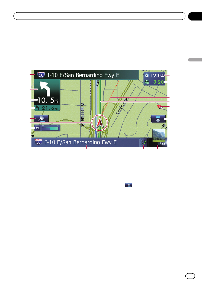
Most of the information provided by yournavigation system can beseen on the map. You need tobe-
come familiar with how information appears on the map.
How to read the map screen
This example shows an example of a 2Dmap screen.
1
8
9 a
b
2
3
4
c
e
d
5
7
6
f
g
p Information with an asterisk (*) appears
only when the route is set.
p Depending on the conditions and settings,
some items may not be displayed.
1 Name of the street to be used (or next gui-
dance point)*
2 Next direction of travel*
As you get closer to the guidancepoint, the
color of the item changesto green.
p Touching this item enables you to hear
the next guidance again.
p You can select between display and
non-display.
= For details, refer to Displaying man-
euvers on page 159.
3 Distance to the guidance point*
Shows the distance to the next guidance
point.
p Touching this item enables you to hear
the next guidance again.
4 Second Maneuver Arrow*
Shows the turning direction after next gui-
dance point and the distance to there.
= For details, refer to Displaying maneu-
vers on page 159.
5 Map control
Touching
displays touch panel keys for
changing the map scale and the map orienta-
tion.
6 Current position
Indicates the current location of your vehicle.
The apex of the triangularmark indicates your
orientation and the display moves automati-
cally as you drive.
p The apex of the triangular mark is the
proper current position of the vehicle.
7 Eco-Meter
Displays a graph comparing the past average
fuel mileage and the average fuel mileage
since the navigation system was last started.
= For details, refer to Displaying the fuel
consumption information on page 159.
En
25
Chapter
04
How to use the map
How to use the map


