


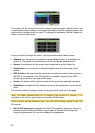

Lock-to-Position: When GPS position is available, N.I.C.E 430 will automatically
keep moving the map to always have the blue (yellow at night) arrow, representing
your actual position, on the screen. You can move the map to lose this position.
Then the Follow button appears on the screen. Tapping it will re-enable Lock-to-
Position. See also Page 32.
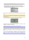
Map Orientation: N.I.C.E 430 is able to rotate the map for your convenience. If you
choose Track-up mode, the map will be rotated to look in the direction of your
heading. Selecting North-up, the map remains oriented to have North toward the top.
Use the left and right hardware buttons to turn your map in the direction you wish.
This will immediately turn off the automatic rotation. A small compass in the top right
section of the map screens (Page 33) will always show the current direction of the
map. Map orientation should not be mixed up with Screen orientation.
North-up: A kind of map orientation having the map rotated to have North toward
the top of the screen. See also Track-up and Map Orientation.
POI: Points Of Interest, exact map locations of important points saved in a database
together with their name, category and subcategories (e.g. Service/Fuel/Autogas),
address, phone and fax number, and other important information. Use the versatile
search system in N.I.C.E 430 to find the appropriate POI near you, your destination
or any other given location on the map (Page 87). You can also have your favorite
places saved as ‘My POI’ in N.I.C.E 430.
Track log: In N.I.C.E 430 you have the possibility to record your journeys using the
position data your GPS provides in every second or every few seconds (depending
on your GPS settings). When you start the recording, position data are saved in the
database until you stop recording it. This set of sequential GPS positions is called
track log. Each set of consecutive positions has a name (originally it is the time of
recording but you can change it to any name you like) and a color in which it can be
displayed on the map. Later you can replay the journey on the screen of N.I.C.E 430
as if it were happening again. This is good for demonstration purposes or for
analyzing your maneuvers during the trip. See also Page 48.
Track-up: A kind of map orientation when the map is rotated to look always in the
direction of your heading. See also North-up and Map Orientation.
Via point: Routes in N.I.C.E 430 can have several (as many as you want) different
destinations to reach in a specific order. All these points except the final destination
are called via points, as the route goes ‘via’ (through) them. The destinations can be
seen in the Route Information screen on the Route line (Page 40), and each via point
is announced by the voice instructions as you approach and when you reach it.
Should your via point serve as a stopover, navigation continues automatically as you
depart. Navigation will resume even if you turn off and on your device or restart
N.I.C.E 430.
Zoom In and Out: The Zoom function is used to change the scale of the map. Use
Zoom In to scale down the map to see less of it but in more detail, and use Zoom
Out to scale the map up to have a broader view of that part of the map with fewer
details. See also Page 18 and Page 31.
95