1
2
3
4
5
6
7
8
9
10
11
12
13
14
15
16
17
18
19
20
21
22
23
68
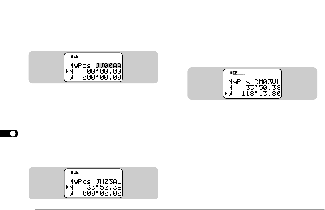
8 Press [UP]/ [DWN] to switch between west longitude
(default) and east longitude.
9 Press [OK].
• The degree digits blink.
10 Press [UP]/ [DWN] to select data for degrees.
11 Press [OK].
• The minute digits blink.
12 Repeat steps 10 and 11 to select data for minutes
(down to one hundredth digit).
13 Press [MENU] to exit Menu mode.
Note:
◆
If have selected “NMEA” in Menu 2–2, pressing [POS] does not allow
you to access the display for entering latitude/ longitude data. The
position data received via the GPS receiver most lately will be
displayed.
◆
If using a GPS receiver, you can also copy the measured data to the
position entry display for Menu 2–3. Press [POS] to display the
measured data, then press [OK]. “COPY to MENU?” appears.
Press [OK] again.
◆
Grid squares were developed to shortly identify locations anywhere
on the Earth. The world is first divided into 324 areas (AA ~ RR)
called “fields”. Each field is then divided into 100 “squares” (00 ~ 99).
Each square is further divided into 576 “sub-squares” (AA ~ XX).
The world is eventually divided into 18, 662, 400 grids; each grid is
expressed with 6 digits.
STA
CON
96
BCON
DUP
9
7
5
ENTERING LATITUDE/ LONGITUDE DATA
This transceiver allows you to manually enter latitude
and longitude data to transmit to other stations.
1 Press [MENU] to enter Menu mode.
• You may press [POS] instead. Then you can skip
step 2.
2 Press [2], [3] to select “2–3 (My Pos)”.
3 Press [UP]/ [DWN] to switch between north latitude
(default) and south latitude.
4 Press [OK].
• The degree digits blink.
5 Press [UP]/ [DWN] to select data for degrees.
6 Press [OK].
• The minute digits blink.
7 Repeat steps 5 and 6 to select data for minutes
(down to one hundredth digit).
STA
CON
96
BCON
DUP
9
7
5
Grid square
locator
STA
CON
96
BCON
DUP
9
7
5
TH-D7 E 61 APRS 98.12.4, 0:13 PM68


