


1
2
3
4
5
6
7
8
9
10
11
12
13
14
15
16
17
18
19
20
21
22
23
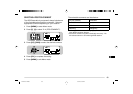
65
STA
CON
96
BCON
DUP
9
7
5
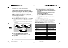
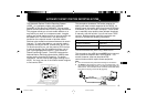
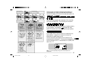
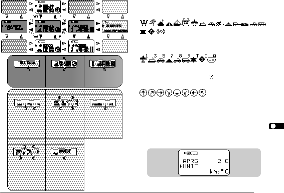
This transceiver is capable of displaying the following 18
icons as station IDs. When icon data other than these is
received, the display will show an icon code such as /$ or \$.
Some icons may appear with characters if the received
icon data includes them. The following are examples:
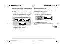
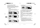
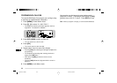
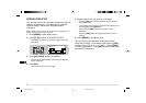
The following icons show the directions of stations relative
to your position. For example, “ ” indicates the other
station is located at the northeast relative to your position.
0.0 to 9999 miles (or km) are shown for distances from
other stations. “xxxxmi” (or “xxxxkm”) is shown for
distances over 9999 miles (or km).
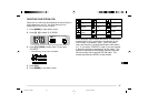
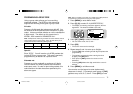
On this transceiver the default units for distance and
temperature are mile and °F. You can also change these
units to kilometer and °C. Access Menu 2–C (UNIT) and
select “km, °C”.
Note: You cannot separately change the units of distance and
temperature.
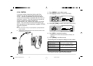
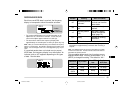
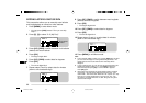
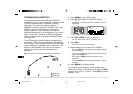
q Call sign
Fixed station
1
Fixed stationMobile station
q Latitude/ longitude
data
N: North S: South
W: West E: East
Object {page 63}Weather station
q Position
comment
(or status text)
q Grid square locator
w Distance from
the station
(mile or km)
q Transmit power
w Height of antenna
(elevation)
’ : Feet M: Meter
e Antenna gain
r Antenna directivity
omni: Omnidirectional
q Transmit range
(mile or km)
1
Using compressed
APRS data format
q Moving direction
w Moving speed
m: Mile/hour
k: km/hour
q Wind direction
w Wind speed
m: Mile/hour
k: km/hour
e Temperature
F: ° F c: °C
r
Amount of rainfall in
the past hour (" or mm)
TH-D7 E 61 APRS 98.12.4, 0:13 PM65