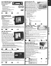
Maptech Waterproof Compact ChartKits
I
NCLUDES COMPANION CD
At half the size of the original ChartKit, each title covers approximately one-third the area of a full-size version. These titles are printed on tough,tear-resistant
p
lastic pages that are also totally waterproof. All coastal U.S.titles include FREE Companion Charts for the region which may be downloaded to your PC.
Features include: • Compact 12” x 17” size
•
Pre-plotted courses and GPS waypoints for quick reference
• Digital charts & software for your PC for home planning & onboard navigation.
Item
Model Region Ship Net
805660 CCK031-01
Narragansett Bay 2 lbs
$64.99
805661 CCK041-01
Upper Chesapeake Bay 2 lbs
64.99
805662 CCK091-01
N
orthern Bahamas 2 lbs
64.99
805663 CCK111-01
Virgn Islands 2 lbs
64.99
NEW PRODUCTS
SHOP 24/7 AT WWW.DEFENDER.COM
6
Maptech ChartKit Full Size Paper Chartbooks
INCLUDES COMPANION CD
2
2” x 17” spiral bound full-color reproductions of U.S.government and private charts.Companion CDs include "Offshore Navigator Lite"
software.Click your mouse to create a waypoint.Click again,and a route is created.Distances,bearings and GPS positions are calculated
a
nd displayed instantly.
Item
Model Region Description Ship Net
805657 PAPR09-06
C
hartKit Region 9 The Bahamas 4 lbs
$141.99
805658 PAPR10-07
ChartKit Region 10 Southern Passages 3 lbs
104.99
805659 PAPR11-01
ChartKit Region 11 Leeward & WIndward Islands 3 lbs
104.99
Maptech Digital Charts
• High resolution Raster Nautical Charts (RNC's) reproduced from original UKHO and Mexico charts
•
BSB4 format
• Maptech's Offshore Navigator Lite software for viewing,planning and printing
Minimum PC Requirements:
• Windows XP (Vista Compatibility on Chart Navigator & Chart Navigator Pro UK/IRL)
• DVD drive
• Video monitor resolution of 256 colors at 800x600 (or better)
• 1 GB of free disk space
• 32 MB of RAM
• Mouse or drawing equivalent
Item
Model Region Ship Net
257078 DVDRCAMEX
Mexico & Central America 2 lbs
$134.99
Maptech Chart Navigator Update
New chart data is available for Chart Navigator users who purchased software before January 1,2008 (everything sold after that date includes these data updates).
• Updated NOAA Raster Charts (RNCs)
•
Ne
w wide-coverage satellite imagery
• Updated Marine Facilities Database
Item
Model Ship Net
257081 SWCNAV2008DATA
2 lbs
$94.99
Chart Navigator Software
• Raster Nautical Charts (RNC's) • BSB4 Format
• Select Satellite photos • Select Tides and Currents
• Maptech's Offshore Navigator software • Real time GPS Tracking
• Autopilot interface • Chart & Route Printing
Minimum PC Requirements:
• Windows XP (Vista Compatibility on Chart Navigator & Chart Navigator Pro UK/IRL)
• DVD drive • Video monitor resolution of 256 colors at 800x600 (or better)
• 1 GB of free disk space • 32 MB of RAM
• Mouse or drawing equivalent
GPS:
• Industry-standard NMEA 0183 GPS • Serial or USB connection cable
Autopilot
• Connected GPS (as above) • Industry-standard NMEA 0183 Autopilot
• Serial data connection cable • Autopilot interface is not required
Item
Model Region
Ship Net
257079 SWCNSCAMEX
Mexico & Central America 2 lbs
$279.99
Maptech Chart Navigator Pro Update
New chart data is available for Chart Navigator Pro users who purchased software before January 1,2008 (everything sold after that date includes these data updates).
• Updated NOAA Raster Charts (RNCs)
•
Updated NO
AA
V
ector Char
ts (ENCs)
• Updated Army Corps of Engineers Vector charts (IENCs)
• New wide-coverage satellite imagery
•
Updated Marine Facilities Database
Item
Model Ship Net
257082 SWCNP2008D
A
TA
2 lbs
$94.99
Maptech The Capn’ Update
Ne
w char
t data is a
vailable f
or
The C
APN who purchased their software before January 1,2008 (everything sold after that date includes these data updates).
• Updated NOAA Raster Charts (RNCs)
• Updated NOAA Vector Charts (ENCs)
•
Updated
Army Corps of Engineers Vector charts (IENCs)
Item
Model Ship Net
257083 SWCPTDATA-08
2 lbs
$94.99
NEW!
NEW!
NEW!
NEW!
NEW!
NEW!
NEW!